
刘家峡水库 topographic map
Interactive map
Click on the map to display elevation.
About this map
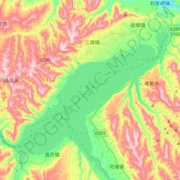
Name: 刘家峡水库 topographic map, elevation, terrain.
Location: 刘家峡水库, 高咀, 东乡族自治县, 临夏回族自治州, 甘肃省, 中国 (35.72012 103.07967 35.94221 103.35116)
Average elevation: 6,365 ft
Minimum elevation: 5,318 ft
Maximum elevation: 7,877 ft