Geolocate

Redwood Junction topographic map

Click on the map to display elevation.

About this map

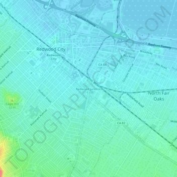
Name: Redwood Junction topographic map, elevation, terrain.

Location: Redwood Junction, Redwood City, San Mateo County, California, 94063, United States (37.45734 -122.24176 37.49734 -122.20176)

Average elevation: 30 ft

Minimum elevation: -7 ft

Maximum elevation: 197 ft

San Mateo County trails, hiking, mountain biking, running and outdoor activities

Other topographic maps

Click on a map to view its topography, its elevation and its terrain.

Gear up for your next adventure:

🎒Hydration Pack - Hands‑free water reservoir for long hikes
🚗GPS Dash Cams - Record your scenic drives through mountain passes and canyons
🗻Climbing Gear Basics - Essential gear for beginner climbers
📦Gear Storage Bags - Organize and protect outdoor equipment
📚Navigation Handbooks - Master the art of reading topographic maps and using a compass

As an Amazon Associate, this site earns from qualifying purchases at no extra cost to you.