
晴朗乡 topographic map
Interactive map
Click on the map to display elevation.
About this map
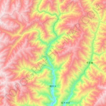
Name: 晴朗乡 topographic map, elevation, terrain.
Location: 晴朗乡, 黑水县, 阿坝藏族羌族自治州, 四川省, 中国 (32.17282 102.90131 32.46937 103.25224)
Average elevation: 11,424 ft
Minimum elevation: 7,067 ft
Maximum elevation: 15,020 ft
Other topographic maps
Click on a map to view its topography, its elevation and its terrain.