Geolocate

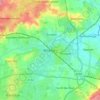
Rayleigh topographic map

Click on the map to display elevation.

About this map
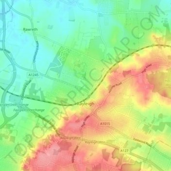
Name: Rayleigh topographic map, elevation, terrain.

Location: Rayleigh, Rochford, Essex, England, United Kingdom (51.57052 0.56227 51.61781 0.64926)

Average elevation: 121 ft

Minimum elevation: 3 ft

Maximum elevation: 282 ft

Other topographic maps

Click on a map to view its topography, its elevation and its terrain.
Saffron Walden

United Kingdom > England > Essex > Uttlesford

Average elevation: 289 ft

Bulphan

United Kingdom > England > Essex

Average elevation: 33 ft

Winter Gardens

United Kingdom > England > Essex > Castle Point

Average elevation: 30 ft

Ramsden Heath

United Kingdom > England > Essex > Chelmsford

Average elevation: 190 ft

Wickford

United Kingdom > England > Essex

Average elevation: 89 ft

Little Walden

United Kingdom > England > Essex > Uttlesford

Average elevation: 308 ft

Hadleigh

United Kingdom > England > Essex > Castle Point

Average elevation: 95 ft

Stroud Green

United Kingdom > England > Essex > Rochford

Average elevation: 72 ft

Gear up for your next adventure:

🌧️Backpack Rain Cover - Keep gear dry in wet weather
🗃️Trail First Aid Kit - Essential kit for outdoor injuries and emergencies
🔦Compact Flashlight - Reliable flashlight for emergencies
🧼Biodegradable Camping Soap - Eco‑friendly soap for outdoor hygiene
⛺Backpacking Tents - Weight-optimized shelters for multi-day topographic surveys

As an Amazon Associate, this site earns from qualifying purchases at no extra cost to you.