
Plasnes topographic map
Interactive map
Click on the map to display elevation.
About this map
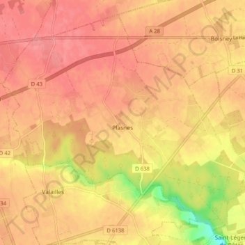
Name: Plasnes topographic map, elevation, terrain.
Average elevation: 522 ft
Minimum elevation: 354 ft
Maximum elevation: 584 ft
Other topographic maps
Click on a map to view its topography, its elevation and its terrain.
Saint-Georges-du-Vièvre
Saint-Georges-du-Vièvre, Bernay, Eure, Normandia, Francia metropolitana, 27450, Francia
Average elevation: 489 ft
Pont-Audemer
Pont-Audemer, Bernay, Eure, Normandia, Francia metropolitana, 27500, Francia
Average elevation: 272 ft