
湾里管理局 topographic map
Interactive map
Click on the map to display elevation.
About this map
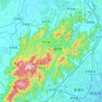
Name: 湾里管理局 topographic map, elevation, terrain.
Location: 湾里管理局, 新建区, 佘牟村, 新建区, 南昌市, 江西省, 中国 (28.66580 115.62368 28.91229 115.81742)
Average elevation: 459 ft
Minimum elevation: 43 ft
Maximum elevation: 2,700 ft