
Mas Bellsolà topographic map
Interactive map
Click on the map to display elevation.
About this map
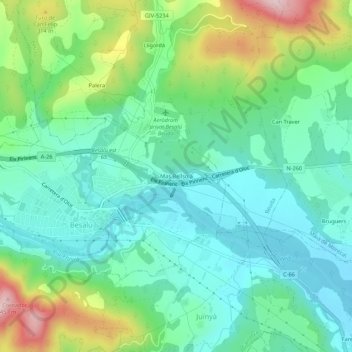
Name: Mas Bellsolà topographic map, elevation, terrain.
Location: Mas Bellsolà, Besalú, Garrotxa, Gerona, Cataluña, 17850, España (42.18417 2.69058 42.22417 2.73058)
Average elevation: 686 ft
Minimum elevation: 390 ft
Maximum elevation: 1,430 ft