
Pulau Senang topographic map
Interactive map
Click on the map to display elevation.
About this map
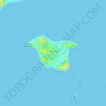
Name: Pulau Senang topographic map, elevation, terrain.
Location: Pulau Senang, Southwest, Singapore (1.16638 103.72850 1.17623 103.74164)
Average elevation: 3 ft
Minimum elevation: 0 ft
Maximum elevation: 121 ft
Other topographic maps
Click on a map to view its topography, its elevation and its terrain.
Singapore Botanic Gardens
Singapore Botanic Gardens, Tanglin, Singapore, Central, 259569, Singapore
Average elevation: 72 ft
Gardens by the Bay
Gardens by the Bay, Marina South, Singapore, Central, Singapore
Average elevation: 16 ft
Artificial Island
Artificial Island, Singapore, Central, Singapore
Average elevation: 56 ft