

Santos topographic map
Click on the map to display elevation.
Santos
Santos partially lies on the island of São Vicente (Saint Vincent), whose territory is divided with the neighboring municipality of São Vicente. It is a densely urbanized area of 39.4 km2 (15.2 sq mi) that houses almost all the inhabitants of the city. It includes a flat area - Plain Coastal extension of the State of São Paulo - which has altitudes that rarely go above twenty meters above sea level, and an area composed of isolated hills called the Mass of São Vicente, the former home and endowed an urban illegal occupation with a mix of families characterized by high and low incomes, whose height does not exceed 200 meters above sea level.
About this map
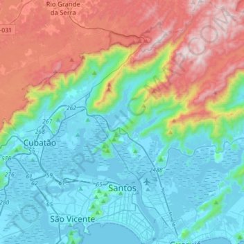
Name: Santos topographic map, elevation, terrain.
Average elevation: 1,086 ft
Minimum elevation: -10 ft
Maximum elevation: 3,822 ft