
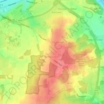
Hertford Heath topographic map
Interactive map
Click on the map to display elevation.
About this map
Name: Hertford Heath topographic map, elevation, terrain.
Average elevation: 243 ft
Minimum elevation: 108 ft
Maximum elevation: 335 ft
Other topographic maps
Click on a map to view its topography, its elevation and its terrain.
Ware
United Kingdom > England > Hertfordshire > East Hertfordshire
Ware, East Hertfordshire, Hertfordshire, England, United Kingdom
Average elevation: 180 ft
Stanstead Abbotts
United Kingdom > England > Hertfordshire > East Hertfordshire
Stanstead Abbotts, East Hertfordshire, Hertfordshire, England, SG12 8HU, United Kingdom
Average elevation: 157 ft
Bishop's Stortford
United Kingdom > England > Hertfordshire > East Hertfordshire
Bishop's Stortford, East Hertfordshire, Hertfordshire, England, United Kingdom
Average elevation: 272 ft