
Thank you for supporting this site ❤️
Make a donation
Make a donation
Gear up for your next adventure:
As an Amazon Associate, this site earns from qualifying purchases at no extra cost to you.
Carlsgrün topographic map
Click on the map to display elevation.
Thank you for supporting this site ❤️
Make a donation
Make a donation
Gear up for your next adventure:
As an Amazon Associate, this site earns from qualifying purchases at no extra cost to you.
About this map
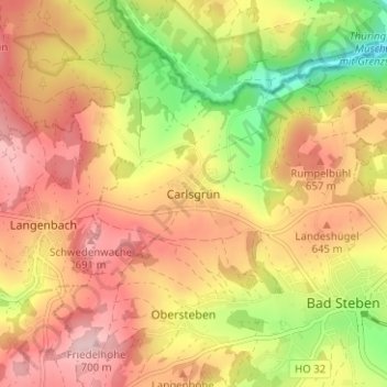
Name: Carlsgrün topographic map, elevation, terrain.
Location: Carlsgrün, Bad Steben, Landkreis Hof, Bavaria, 95138, Germany (50.35740 11.59941 50.39740 11.63941)
Average elevation: 2,008 ft
Minimum elevation: 1,608 ft
Maximum elevation: 2,306 ft
Thank you for supporting this site ❤️
Make a donation
Make a donation
Gear up for your next adventure:
As an Amazon Associate, this site earns from qualifying purchases at no extra cost to you.