
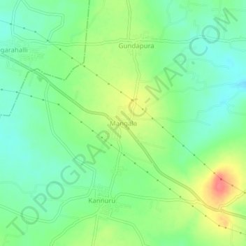
Mangala topographic map
Interactive map
Click on the map to display elevation.
About this map
Name: Mangala topographic map, elevation, terrain.
Average elevation: 2,257 ft
Minimum elevation: 2,178 ft
Maximum elevation: 2,388 ft
Other topographic maps
Click on a map to view its topography, its elevation and its terrain.
Ramapura
India > Karnataka > Hanur taluk
Ramapura, Hanur taluk, Chamarajanagar District, Karnataka, India
Average elevation: 2,192 ft
Hanur
India > Karnataka > Hanur taluk
Hanur, Hanur taluk, Chamarajanagar District, Karnataka, 571439, India
Average elevation: 2,208 ft