
Bolland topographic map
Interactive map
Click on the map to display elevation.
About this map
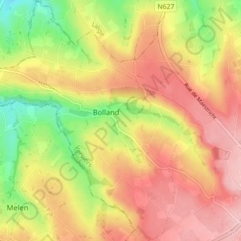
Name: Bolland topographic map, elevation, terrain.
Location: Bolland, Herve, Verviers, Liège, Wallonie, 4650, Belgique (50.64077 5.73002 50.67937 5.77988)
Average elevation: 810 ft
Minimum elevation: 535 ft
Maximum elevation: 1,017 ft
Other topographic maps
Click on a map to view its topography, its elevation and its terrain.
Xhendelesse
Belgique > Liège > Verviers > Herve
Xhendelesse, Herve, Verviers, Liège, Wallonie, 4650, Belgique
Average elevation: 794 ft