
楊屋村 topographic map
Interactive map
Click on the map to display elevation.
About this map
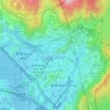
Name: 楊屋村 topographic map, elevation, terrain.
Location: 楊屋村, 關門口村, 荃灣區, 新界, 香港, 中国 (22.35187 114.10566 22.39187 114.14566)
Average elevation: 384 ft
Minimum elevation: -49 ft
Maximum elevation: 1,604 ft