Geolocate

Merrivale topographic map

Click on the map to display elevation.

About this map
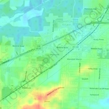
Name: Merrivale topographic map, elevation, terrain.

Location: Merrivale, Little Rock, Pulaski County, Arkansas, 72209, United States (34.64731 -92.39404 34.68731 -92.35404)

Average elevation: 299 ft

Minimum elevation: 249 ft

Maximum elevation: 400 ft

Pulaski County trails, hiking, mountain biking, running and outdoor activities

Gear up for your next adventure:

🏕️Family Camping Gear - Essentials for group camping trips
🪶Fire Starter Kit - Reliable fire starter for survival and camping
🥇GPS Hiking Watch - Multi‑sport GPS watch with navigation and trail tracking
🧤Hiking Gloves - Protective gloves for rugged trails
🎒Day Hiking Backpack - Lightweight backpack perfect for day trips and outdoor adventures

As an Amazon Associate, this site earns from qualifying purchases at no extra cost to you.