
Axminster topographic map
Interactive map
Click on the map to display elevation.
About this map
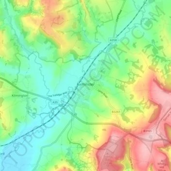
Name: Axminster topographic map, elevation, terrain.
Location: Axminster, East Devon, Devon, England, United Kingdom (50.75227 -3.04285 50.81098 -2.94095)
Average elevation: 282 ft
Minimum elevation: 20 ft
Maximum elevation: 738 ft
Other topographic maps
Click on a map to view its topography, its elevation and its terrain.
Branscombe
United Kingdom > England > Devon > East Devon > Branscombe
Branscombe, East Devon, Devon, South West England, England, EX12 3DJ, United Kingdom
Average elevation: 256 ft