
Northport topographic map
Click on the map to display elevation.
About this map
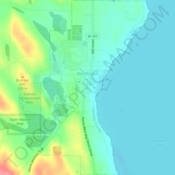
Name: Northport topographic map, elevation, terrain.
Location: Northport, Leelanau County, Michigan, 49670, United States (45.11337 -85.62864 45.14436 -85.60087)
Average elevation: 633 ft
Minimum elevation: 564 ft
Maximum elevation: 843 ft
Leelanau County trails, hiking, mountain biking, running and outdoor activities
Other topographic maps
Click on a map to view its topography, its elevation and its terrain.
Sleeping Bear Dunes
United States > Michigan > Leelanau County > Glen Arbor Township
Average elevation: 656 ft
Hatchs
United States > Michigan > Leelanau County > Elmwood Charter Township
Average elevation: 728 ft
South Fox Island
United States > Michigan > Leelanau County
North Fox Island has an operational public 3,001-foot-long by 100-foot-wide (914m x 30m) grass airstrip as of August 2023, making it accessible by general aviation. Runway 7 has a displaced threshold of 804 ft. and Runway 25 has a displaced threshold of 999 ft. Both runways have trees at their ends ranging…
Average elevation: 607 ft