Fontaine topographic map
Interactive map
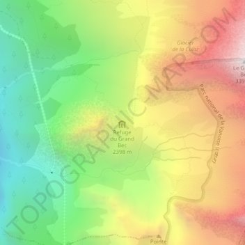
Click on the map to display elevation.
About this map
Name: Fontaine topographic map, elevation, terrain.
Average elevation: 7,546 ft
Minimum elevation: 4,633 ft
Maximum elevation: 11,020 ft

Click on the map to display elevation.
Name: Fontaine topographic map, elevation, terrain.
Average elevation: 7,546 ft
Minimum elevation: 4,633 ft
Maximum elevation: 11,020 ft