
Bois d'olive topographic map
Interactive map
Click on the map to display elevation.
About this map
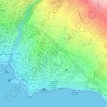
Name: Bois d'olive topographic map, elevation, terrain.
Average elevation: 233 ft
Minimum elevation: 0 ft
Maximum elevation: 699 ft
Other topographic maps
Click on a map to view its topography, its elevation and its terrain.
Rivière d'Abord
France > La Réunion > Saint-Pierre > Terre Sainte
Rivière d'Abord, Terre Sainte, Saint-Pierre, La Réunion, 97410, France
Average elevation: 663 ft