
Bayou Segnette State Park topographic map
Interactive map
Click on the map to display elevation.
About this map
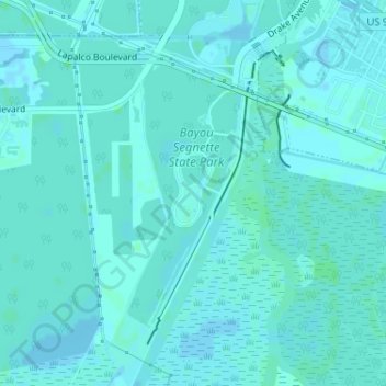
Name: Bayou Segnette State Park topographic map, elevation, terrain.
Location: Bayou Segnette State Park, Jefferson Parish, Louisiana, USA (29.87334 -90.17127 29.90132 -90.15371)
Average elevation: 7 ft
Minimum elevation: -3 ft
Maximum elevation: 13 ft
Other topographic maps
Click on a map to view its topography, its elevation and its terrain.
Chapman Bay
Chapman Bay, State Route 3102, Larto, Catahoula Parish, Louisiana, USA
Average elevation: 49 ft