
L'Église topographic map
Interactive map
Click on the map to display elevation.
About this map
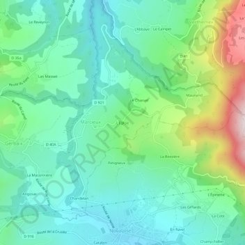
Name: L'Église topographic map, elevation, terrain.
Average elevation: 1,890 ft
Minimum elevation: 1,371 ft
Maximum elevation: 3,314 ft
Other topographic maps
Click on a map to view its topography, its elevation and its terrain.
Château Richard
France > Auvergne-Rhône-Alpes > Savoie > Marcieux
Château Richard, Marcieux, Chambéry, Savoie, Auvergne-Rhône-Alpes, France métropolitaine, 73470, France
Average elevation: 3,471 ft
Maunand
France > Auvergne-Rhône-Alpes > Savoie > Marcieux
Maunand, Marcieux, Chambéry, Savoie, Auvergne-Rhône-Alpes, France métropolitaine, 73470, France
Average elevation: 2,484 ft