Dundry topographic map
Interactive map
Click on the map to display elevation.
About this map
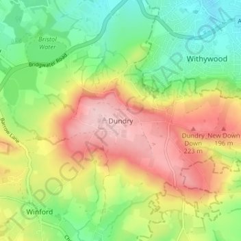
Name: Dundry topographic map, elevation, terrain.
Average elevation: 410 ft
Minimum elevation: 128 ft
Maximum elevation: 755 ft

Click on the map to display elevation.
Name: Dundry topographic map, elevation, terrain.
Average elevation: 410 ft
Minimum elevation: 128 ft
Maximum elevation: 755 ft