
Leobschütz topographic map
Interactive map
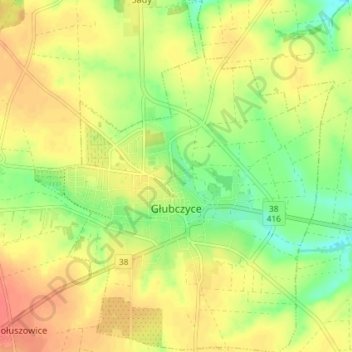
Click on the map to display elevation.
About this map
Name: Leobschütz topographic map, elevation, terrain.
Average elevation: 899 ft
Minimum elevation: 814 ft
Maximum elevation: 968 ft
Die Stadt Głubczyce liegt im Südwesten von Oberschlesien, rund 50 Kilometer südlich der Woiwodschaftshauptstadt Opole (Oppeln) und fünf Kilometer östlich der Grenze zu Tschechien. Der Ort liegt in der Nizina Śląska (Schlesische Tiefebene) innerhalb der Płaskowyż Głubczycki (Leobschützer Lößhügelland) auf einer Höhe von 266 Metern über NHN. Durch die Stadt fließt die Psina (Zinna), ein linker Zufluss der Oder.
Other topographic maps
Click on a map to view its topography, its elevation and its terrain.
Osterdorf
Polen > Woiwodschaft Oppeln > powiat głubczycki
Osterdorf, gmina Branice, powiat głubczycki, Woiwodschaft Oppeln, 48-140, Polen
Average elevation: 1,014 ft