Geolocate

Ypres topographic map

Click on the map to display elevation.

About this map
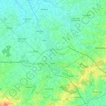
Name: Ypres topographic map, elevation, terrain.

Location: Ypres, Ieper, West Flanders, Flanders, Belgium (50.79361 2.76906 50.93871 2.97650)

Average elevation: 79 ft

Minimum elevation: 0 ft

Maximum elevation: 384 ft

Other topographic maps

Click on a map to view its topography, its elevation and its terrain.
Polderhoek

Belgium > West Flanders > Ieper > Zonnebeke > Geluveld > Poezelhoek

Average elevation: 148 ft
Kemmelberg

Belgium > West Flanders > Ieper > Heuvelland

Average elevation: 223 ft

Rodeberg

Belgium > West Flanders > Ieper > Heuvelland

Average elevation: 269 ft

Gear up for your next adventure:

🛌Ultralight Sleeping Bags - Compact down bags for cold nights in the wilderness
🪶Trail Camera - Capture wildlife on your hikes
📻Weather Alert Radios - Stay informed of storm risks while off-the-grid
🗻Climbing Gear Basics - Essential gear for beginner climbers
🌄Hiking Binoculars - Compact binoculars for scenic views and trail spotting

As an Amazon Associate, this site earns from qualifying purchases at no extra cost to you.