
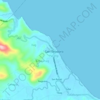
Poblacion topographic map
Interactive map
Click on the map to display elevation.
About this map
Name: Poblacion topographic map, elevation, terrain.
Average elevation: 72 ft
Minimum elevation: 0 ft
Maximum elevation: 807 ft
Other topographic maps
Click on a map to view its topography, its elevation and its terrain.
Tacligan
Philippines > Oriental Mindoro > San Teodoro
Tacligan, San Teodoro, Oriental Mindoro, Mimaropa, 5202, Philippines
Average elevation: 62 ft
Binaybay
Philippines > Oriental Mindoro > San Teodoro > Teboy
Binaybay, Calangatan, Teboy, San Teodoro, Oriental Mindoro, Mimaropa, 5202, Philippines
Average elevation: 177 ft
Calabugao
Philippines > Oriental Mindoro > San Teodoro
Calabugao, San Teodoro, Oriental Mindoro, Mimaropa, 5202, Philippines
Average elevation: 92 ft