
Plaza Grau Punchana topographic map
Interactive map
Click on the map to display elevation.
About this map
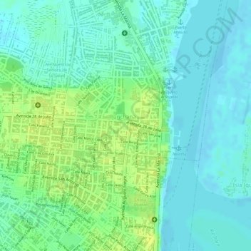
Name: Plaza Grau Punchana topographic map, elevation, terrain.
Location: Plaza Grau Punchana, Punchana, Maynas, Loreto, Perú (-3.72890 -73.24467 -3.72801 -73.24407)
Average elevation: 292 ft
Minimum elevation: 266 ft
Maximum elevation: 325 ft
Other topographic maps
Click on a map to view its topography, its elevation and its terrain.
Laguna Viejacocha
Perú > Loreto > Punchana > Santo Tomas > Lupunillo
Laguna Viejacocha, Lupunillo, Santo Tomas, Punchana, Maynas, Loreto, Perú
Average elevation: 282 ft
Lupunillo
Perú > Loreto > Punchana > Santo Tomas
Lupunillo, Santo Tomas, Punchana, Maynas, Loreto, 16001, Perú
Average elevation: 279 ft