
詹曲 topographic map
Interactive map
Click on the map to display elevation.
About this map
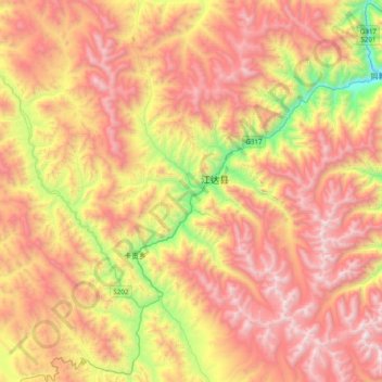
Name: 詹曲 topographic map, elevation, terrain.
Location: 詹曲, 江达县, 昌都市, 西藏自治区, 中国 (31.39010 97.99989 31.59116 98.39034)
Average elevation: 14,104 ft
Minimum elevation: 10,636 ft
Maximum elevation: 17,041 ft
Other topographic maps
Click on a map to view its topography, its elevation and its terrain.