
Torgnon topographic map
Interactive map
Click on the map to display elevation.
About this map
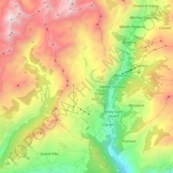
Name: Torgnon topographic map, elevation, terrain.
Location: Torgnon, Aostatal, Italien (45.76371 7.52457 45.88348 7.60334)
Average elevation: 6,440 ft
Minimum elevation: 2,192 ft
Maximum elevation: 11,463 ft