
Missen topographic map
Interactive map
Click on the map to display elevation.
About this map
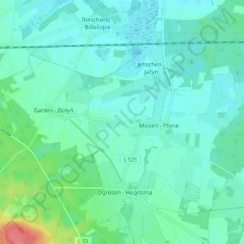
Name: Missen topographic map, elevation, terrain.
Average elevation: 243 ft
Minimum elevation: 203 ft
Maximum elevation: 410 ft
Other topographic maps
Click on a map to view its topography, its elevation and its terrain.
Belten
Deutschland > Brandenburg > Oberspreewald-Lausitz > Vetschau/Spreewald
Belten, Stadt Vetschau, Vetschau/Spreewald, Oberspreewald-Lausitz, Brandenburg, 03226, Deutschland
Average elevation: 210 ft
Gahlen
Deutschland > Brandenburg > Oberspreewald-Lausitz > Vetschau/Spreewald
Gahlen, Missen, Vetschau/Spreewald, Oberspreewald-Lausitz, Brandenburg, Deutschland
Average elevation: 249 ft
Raddusch
Deutschland > Brandenburg > Oberspreewald-Lausitz > Vetschau/Spreewald
Raddusch, Vetschau/Spreewald, Oberspreewald-Lausitz, Brandenburg, Deutschland
Average elevation: 177 ft