
Victoria topographic map
Interactive map
Click on the map to display elevation.
About this map
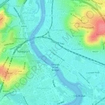
Name: Victoria topographic map, elevation, terrain.
Location: Victoria, Newport, Wales, NP, United Kingdom (51.58126 -2.99391 51.59463 -2.97368)
Average elevation: 66 ft
Minimum elevation: 0 ft
Maximum elevation: 266 ft
Other topographic maps
Click on a map to view its topography, its elevation and its terrain.
Marshfield
United Kingdom > Wales > Newport
Marshfield, Newport, Wales, United Kingdom
Average elevation: 59 ft
Caerleon
United Kingdom > Wales > Newport > Caerleon
Caerleon, Newport, Wales, NP18 1AF, United Kingdom
Average elevation: 121 ft
Beechwood
United Kingdom > Wales > Newport
Beechwood, Newport, Wales, NP, United Kingdom
Average elevation: 92 ft