
Tschengla topographic map
Interactive map
Click on the map to display elevation.
About this map
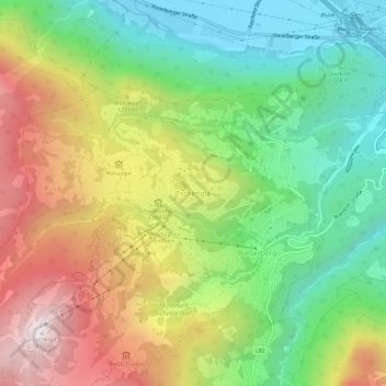
Name: Tschengla topographic map, elevation, terrain.
Average elevation: 3,468 ft
Minimum elevation: 1,726 ft
Maximum elevation: 5,909 ft
Other topographic maps
Click on a map to view its topography, its elevation and its terrain.
Gemeinde Bürserberg
Österreich > Vorarlberg > Bezirk Bludenz > Gemeinde Bürserberg
Gemeinde Bürserberg, Bezirk Bludenz, Vorarlberg, 6707, Österreich
Average elevation: 4,157 ft