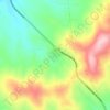
Moscow topographic map
Click on the map to display elevation.
Moscow
Along with the rest of the Idaho Panhandle, Moscow is in the Pacific Time Zone. The elevation of its city center is 2,579 feet (786 m) above sea level. Two major highways serve the city, passing through the city center: US-95 (north-south) and ID-8 (east-west). The Pullman–Moscow Regional Airport, four miles (6 km) west, provides limited commercial air service. The local newspaper is the Moscow-Pullman Daily News.
About this map

Name: Moscow topographic map, elevation, terrain.
Location: Moscow, Latah County, Idaho, United States (46.69870 -117.03988 46.75861 -116.96054)
Average elevation: 2,638 ft
Minimum elevation: 2,510 ft
Maximum elevation: 2,995 ft
Latah County trails, hiking, mountain biking, running and outdoor activities
Other topographic maps
Click on a map to view its topography, its elevation and its terrain.