
Rettenbach topographic map
Interactive map
Click on the map to display elevation.
About this map
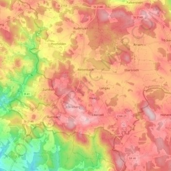
Name: Rettenbach topographic map, elevation, terrain.
Average elevation: 1,900 ft
Minimum elevation: 1,329 ft
Maximum elevation: 2,234 ft
Other topographic maps
Click on a map to view its topography, its elevation and its terrain.
Cham
Duitsland > Beieren > Landkreis Cham
Cham, Landkreis Cham, Beieren, 93413, Duitsland
Average elevation: 1,378 ft
Kapelhof
Duitsland > Beieren > Landkreis Cham > Roding
Kapelhof, Roding, Landkreis Cham, Beieren, 93426, Duitsland
Average elevation: 1,401 ft