Geolocate

Toul topographic map

Click on the map to display elevation.

About this map
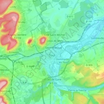
Name: Toul topographic map, elevation, terrain.

Location: Toul, Meurthe-et-Moselle, Grand Est, Metropolitan France, 54200, France (48.63026 5.85474 48.72856 5.94123)

Average elevation: 804 ft

Minimum elevation: 643 ft

Maximum elevation: 1,306 ft

Other topographic maps

Click on a map to view its topography, its elevation and its terrain.

Lemont

France > Grand Est > Meurthe-et-Moselle > Cosnes-et-Romain

Average elevation: 1,191 ft

La Puce

France > Grand Est > Meurthe-et-Moselle > Boismont

Average elevation: 938 ft

Gear up for your next adventure:

🥾Women's Hiking Boots - Top-rated trail boots with ankle support and superior grip
📚USA Hiking Guide Books - Top trail guides and map books
⌚Solar GPS Watches - Advanced multisport watches with built-in topographic maps
🎒Outdoor Daypacks - Lightweight backpacks designed for carrying maps and essential gear
🩹Survival Bandages - High‑quality bandages for emergencies

As an Amazon Associate, this site earns from qualifying purchases at no extra cost to you.