
La Malahá topographic map
Interactive map
Click on the map to display elevation.
About this map
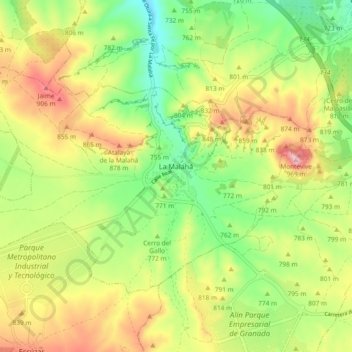
Name: La Malahá topographic map, elevation, terrain.
Location: La Malahá, Comarca de Alhama, Granada, Andalucía, España (37.07438 -3.78038 37.12413 -3.68710)
Average elevation: 2,556 ft
Minimum elevation: 2,106 ft
Maximum elevation: 3,140 ft