
Rita topographic map
Interactive map
Click on the map to display elevation.
About this map
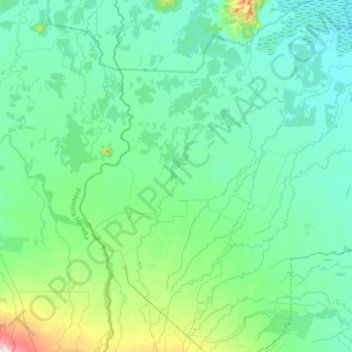
Name: Rita topographic map, elevation, terrain.
Location: Rita, Cantón Pococí, Provincia Limón, 70203, Costa Rica (10.25995 -83.88041 10.60871 -83.62561)
Average elevation: 164 ft
Minimum elevation: 7 ft
Maximum elevation: 938 ft