
Ampfing topographic map
Interactive map
Click on the map to display elevation.
About this map
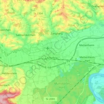
Name: Ampfing topographic map, elevation, terrain.
Location: Ampfing, Landkreis Mühldorf am Inn, Bavière, 84539, Allemagne (48.22401 12.32045 48.29585 12.45590)
Average elevation: 1,421 ft
Minimum elevation: 1,240 ft
Maximum elevation: 1,785 ft