
Thank you for supporting this site ❤️
Make a donation
Make a donation
Gear up for your next adventure:
As an Amazon Associate, this site earns from qualifying purchases at no extra cost to you.
Louseiro topographic map
Click on the map to display elevation.
Thank you for supporting this site ❤️
Make a donation
Make a donation
Gear up for your next adventure:
As an Amazon Associate, this site earns from qualifying purchases at no extra cost to you.
About this map
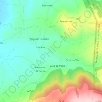
Name: Louseiro topographic map, elevation, terrain.
Location: Louseiro, Sarria, Lugo, Galicia, 27615, Spain (42.77881 -7.35997 42.79604 -7.32749)
Average elevation: 1,657 ft
Minimum elevation: 1,365 ft
Maximum elevation: 2,224 ft
Thank you for supporting this site ❤️
Make a donation
Make a donation
Gear up for your next adventure:
As an Amazon Associate, this site earns from qualifying purchases at no extra cost to you.