
Sesto Calende topographic map
Interactive map
Click on the map to display elevation.
About this map
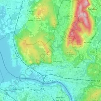
Name: Sesto Calende topographic map, elevation, terrain.
Location: Sesto Calende, Varese, Lombardia, 21018, Italia (45.71080 8.58243 45.77791 8.67815)
Average elevation: 850 ft
Minimum elevation: 617 ft
Maximum elevation: 1,532 ft