
Le Grand Taureau topographic map
Interactive map
Click on the map to display elevation.
About this map
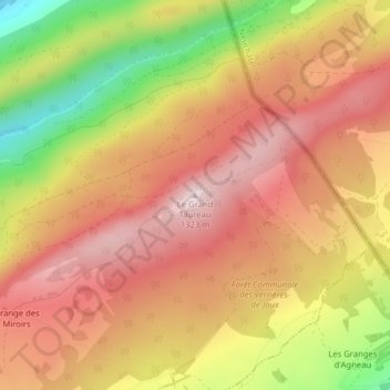
Name: Le Grand Taureau topographic map, elevation, terrain.
Average elevation: 3,793 ft
Minimum elevation: 2,986 ft
Maximum elevation: 4,304 ft
Other topographic maps
Click on a map to view its topography, its elevation and its terrain.
Les Épinettes
Frankreich > Burgund und Freigrafschaft > Doubs > Pontarlier
Les Épinettes, Stand-Chirvaux-Gare, Pontarlier, Doubs, Burgund und Freigrafschaft, Metropolitanes Frankreich, 25300, Frankreich
Average elevation: 2,818 ft