
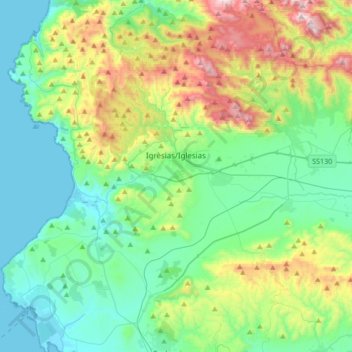
Igrèsias/Iglesias topographic map
Interactive map
Click on the map to display elevation.
About this map
Name: Igrèsias/Iglesias topographic map, elevation, terrain.
Location: Igrèsias/Iglesias, Sulcis Iglesiente, Sardinien, 09016, Italien (39.21212 8.37302 39.37960 8.71037)
Average elevation: 843 ft
Minimum elevation: -3 ft
Maximum elevation: 3,327 ft