
Monte Sillara topographic map
Interactive map
Click on the map to display elevation.
About this map
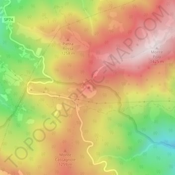
Name: Monte Sillara topographic map, elevation, terrain.
Location: Monte Sillara, Corniglio, PR, EMR, Italia (44.48456 10.01147 44.48466 10.01157)
Average elevation: 3,737 ft
Minimum elevation: 2,572 ft
Maximum elevation: 4,616 ft
Other topographic maps
Click on a map to view its topography, its elevation and its terrain.
Lago Santo parmense
Lago Santo parmense, 723a/b, Corniglio, PR, EMR, Italia
Average elevation: 4,898 ft