
Thank you for supporting this site ❤️
Make a donation
Make a donation
Gear up for your next adventure:
As an Amazon Associate, this site earns from qualifying purchases at no extra cost to you.
Minatitlán topographic map
Click on the map to display elevation.
Thank you for supporting this site ❤️
Make a donation
Make a donation
Gear up for your next adventure:
As an Amazon Associate, this site earns from qualifying purchases at no extra cost to you.
About this map
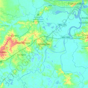
Name: Minatitlán topographic map, elevation, terrain.
Location: Minatitlán, Veracruz, 96730, Mexico (17.83277 -94.71671 18.15277 -94.39671)
Average elevation: 36 ft
Minimum elevation: -10 ft
Maximum elevation: 230 ft
Thank you for supporting this site ❤️
Make a donation
Make a donation
Gear up for your next adventure:
As an Amazon Associate, this site earns from qualifying purchases at no extra cost to you.