
Le Thérondel topographic map
Interactive map
Click on the map to display elevation.
About this map
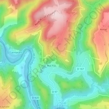
Name: Le Thérondel topographic map, elevation, terrain.
Average elevation: 1,453 ft
Minimum elevation: 1,007 ft
Maximum elevation: 2,093 ft
Other topographic maps
Click on a map to view its topography, its elevation and its terrain.
Vallée d'Estaing
Vallée d'Estaing, D 103, Estaing, Argelès-Gazost, Hautes-Pyrénées, Occitanie, France métropolitaine, 65400, France
Average elevation: 5,381 ft
Lac d'Ilhéou
Lac d'Ilhéou, GR 10, Estaing, Argelès-Gazost, Hautes-Pyrénées, Occitanie, France métropolitaine, 65400, France
Average elevation: 7,215 ft
Grand Barbat
Grand Barbat, Estaing, Argelès-Gazost, Hautes-Pyrénées, Occitanie, France métropolitaine, 65400, France
Average elevation: 7,776 ft