
La Cruz topographic map
Interactive map
Click on the map to display elevation.
About this map
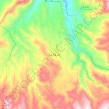
Name: La Cruz topographic map, elevation, terrain.
Location: La Cruz, Rio Mayo, Nariño, Colombie (1.56034 -77.01117 1.64034 -76.93117)
Average elevation: 7,910 ft
Minimum elevation: 6,309 ft
Maximum elevation: 9,596 ft