
İçdedeler topographic map
Interactive map
Click on the map to display elevation.
About this map
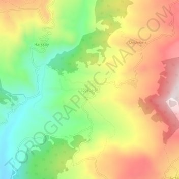
Name: İçdedeler topographic map, elevation, terrain.
Location: İçdedeler, Taraklı, Sakarya, Marmara Region, Turkey (40.43317 30.48722 40.47317 30.52722)
Average elevation: 2,644 ft
Minimum elevation: 1,660 ft
Maximum elevation: 3,717 ft