
Thank you for supporting this site ❤️
Make a donation
Make a donation
Gear up for your next adventure:
As an Amazon Associate, this site earns from qualifying purchases at no extra cost to you.
Kühtai topographic map
Click on the map to display elevation.
Thank you for supporting this site ❤️
Make a donation
Make a donation
Gear up for your next adventure:
As an Amazon Associate, this site earns from qualifying purchases at no extra cost to you.
About this map
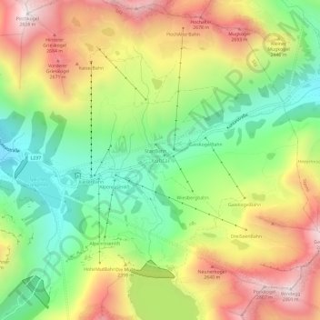
Name: Kühtai topographic map, elevation, terrain.
Location: Kühtai, Gemeinde Silz, Bezirk Imst, Tyrol, 6183, Austria (47.19362 11.00340 47.23362 11.04340)
Average elevation: 7,431 ft
Minimum elevation: 5,991 ft
Maximum elevation: 9,209 ft
Thank you for supporting this site ❤️
Make a donation
Make a donation
Gear up for your next adventure:
As an Amazon Associate, this site earns from qualifying purchases at no extra cost to you.