
Spartanburg topographic map
Interactive map
Click on the map to display elevation.
About this map
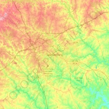
Name: Spartanburg topographic map, elevation, terrain.
Average elevation: 768 ft
Minimum elevation: 449 ft
Maximum elevation: 1,158 ft
Other topographic maps
Click on a map to view its topography, its elevation and its terrain.
Montgomery Acres
United States > South Carolina > Spartanburg County > Spartanburg
Montgomery Acres, Spartanburg, Spartanburg County, South Carolina, 29302, United States
Average elevation: 728 ft