

Navsari topographic map
Click on the map to display elevation.
Navsari
Navsari is located at 20°57′N 72°56′E / 20.95°N 72.93°E / 20.95; 72.93. It has an average elevation of 9 metres or 30 feet above sea level. The city is located in southern Gujarat and is situated near the Purna River, within a few kilometres of the river's delta, which is west of the city and empties into the Gulf of Khambhat. The weather in Navsari is sunny from October to May, and rainy from June to September. The average maximum and minimum temperatures are 42 °C (107.6 °F) and 17 °C (62.6 °F) respectively. The average annual rainfall is 122 cm (48 in).
About this map
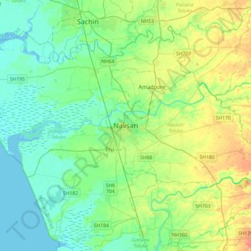
Name: Navsari topographic map, elevation, terrain.
Location: Navsari, Navsari Taluka, Navsari, Gujarat, 396400, India (20.79241 72.77238 21.11241 73.09238)
Average elevation: 46 ft
Minimum elevation: -7 ft
Maximum elevation: 148 ft