
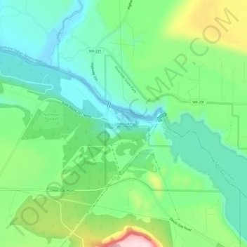
Long Lake topographic map
Interactive map
Click on the map to display elevation.
About this map
Name: Long Lake topographic map, elevation, terrain.
Average elevation: 1,677 ft
Minimum elevation: 1,358 ft
Maximum elevation: 2,405 ft
Other topographic maps
Click on a map to view its topography, its elevation and its terrain.
Fishtrap Lake
United States > Washington > Lincoln County
Fishtrap Lake, Lincoln County, Washington, United States
Average elevation: 2,103 ft
Wilbur
United States > Washington > Lincoln County
Wilbur, Lincoln County, Washington, United States
Average elevation: 2,231 ft
Reardan
United States > Washington > Lincoln County
Reardan, Lincoln County, Washington, United States
Average elevation: 2,510 ft
Davenport
United States > Washington > Lincoln County
Davenport, Lincoln County, Washington, United States
Average elevation: 2,418 ft